The first of many thank-yous.

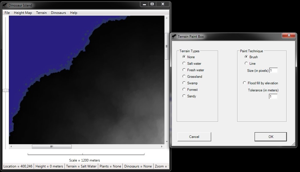
I apologize for not posting more this week on this blog, but I’ve been very busy working on the ‘behind the scenes’ stuff. In particular, I’ve been working on creating the database for all the plants and trees on Dinosaur Island (see the post, just below, on Planting on Dinosaur Island) to get a look at the ‘front end’ of the database).

The ‘front end’ of Dinosaur Island is being written in a computer language called C# using something called Windows Presentation Foundation (WPF). I’m not too familiar with WPF and a couple of days ago I was going crazy trying to find a bug in the interface for creating the plants and trees database. Finally, in desperation, I posted a note on Facebook asking if any of my friends, who knew C# and WPF especially, could help me find the bug. Not even thirty seconds elapsed before I got a message from Mike Splawski offering to help. Mike was a student of mine at the University of Iowa and he found and fixed the bug overnight. Thanks a million, Mike. I’m glad I gave you an ‘A’ for the class!

Also, I need to thank a number of paleontologists and paleobotanists who have been looking at Dinosaur Island and helping me out (especially with the problem of what specific plants and trees that specific herbivorous dinosaurs ate).

Dr. Bonnie Jacobs and Dr. Louis Jacobs, at SMU put me in contact with Dr. Karen Chin, the author of, “What Dinosaurs Ate,” a chapter in the fantastic book, “The Complete Dinosaur.” Dr. Chin very kindly called me and we talked over her research. She also made introductions for me to her thesis adviser, Dr. Bruce Tiffney, Dr. Jim Farlow, one of the editors of, “The Complete Dinosaur,” and Dr. Ian Miller who have all taken time from their busy schedules to write and respond to – what I assume are – my very naive questions.

Before Dinosaur Island is completed I’m sure there will be a long list of people that I will thank. A project like this is absolutely impossible without the kindness of strangers.


Share

Planting on Dinosaur Island.

How we plant on Dinosaur Island; screen capture of the planting interface.

How we plant on Dinosaur Island; screen capture of the planting interface.

It’s spring on Dinosaur Island and that means it’s time to start planting! Above is a screen capture of the interface to add plants to Dinosaur Island, select the terrain / environment in which they grow (remember all the work on creating the terrain previously?), select images for the plants for their three stages of development (we have an agreement with xFrog who created these prehistoric plants, and, lastly, ‘plant’ this vegetation in the appropriate terrain / environment.

We’re looking at starting off with 20 different types of plants and trees. We will be tracking each individual plant, shrub or tree throughout its entire life cycle. We will also track its health.

The above screen capture is another glimpse ‘behind the scenes’ of Dinosaur Island. Most users probably won’t want to get this involved, but we need to have this capability to create different environments, with the appropriate flora, for the various eras of dinosaurs.

Things are progressing rapidly on Dinosaur Island. Next week: see the results of planting all these ferns, bushes and trees. And, after that, it’s time for the dinosaurs!

Share

The terrain of Dinosaur Island.

Dinosaur Island terrain displayed in false colors.

Dinosaur Island terrain displayed in false colors.

Above is a view of Dinosaur Island with the different terrain types displayed in vivid or ‘false colors’. Below is a view of the same terrain types displayed as a transparency over the elevation map of the island.

The terrain of Dinosaur Island displayed as a transparency over the elevation map.

The terrain of Dinosaur Island displayed as a transparency over the elevation map.

Terrain type legend.

Terrain type legend.

The color legend of the different terrain types is at left.

This is exciting news! Well, it is for us on the team because it means that we now have the tools to rapidly create islands and ‘paint’ with the different terrain types. This should be exciting news for you, too, because this means that users (like you) can create your own Dinosaur Islands, too!

So, what’s next?

We will be adding the interface so we can start ‘planting’ vegetation around the island. Every plant grows only in certain terrains. Now you know why we had to create the ‘terrain map’ of Dinosaur Island first.

You know what happens after we add the plants? We start adding the dinosaurs that live on the plants!


Share

How to build a swamp.

Building a swamp on Dinosaur Island.

Building a swamp on Dinosaur Island.

Today’s post shows a screen shot of the process of building up a swamp on Dinosaur Island. The dark blue area is salt water. The alternating brown and yellow bands are sandy and swampy areas. This process was automated by using a “flood fill” algorithm that is now built into the Dinosaur Island program.

Share

Building Dinosaur Island.

Building Dinosaur Island: a look at how terrain, elevation and environmental models are built.

Building Dinosaur Island: a look at how terrain, elevation and environmental models are built.

This is the first peek behind the scenes where you can see how we are building  Dinosaur Island. This will be either really cool, or really boring, so hang on. If you’re a nerd at heart and want to learn how these types of programs are written then today’s post is for you. If this is the kind of thing that bores you to tears you should probably go check out the Dinosaurs in the News section; lots of cool stuff there.

We have been writing M&S (Modeling & Simulation) programs since the mid 1980s. M&S programs are used to model very complex environments and behaviors. For many years we have been working on high-end wargames and emergency disaster simulations for the U.S. Department of Defense, DARPA and other government organizations. While Dinosaur Island doesn’t seem like an M&S program, it really is. In fact, we are modeling Dinosaur Island in greater detail than any of the programs that we’ve done in the past.

For every square meter of Dinosaur Island we need to know:

  • The elevation (in meters).
  • The type of terrain (swamp, forest, fresh water, etc.).
  • The vegetation (every plant and where it is in its life cycle).
  • Any dinosaurs (or considering their size, any parts of dinosaurs in this particular square meter).

This, obviously, is a lot of data. So, one of the first tasks in creating a very large M&S project like Dinosaur Island is to first create the tools that facilitate entering all this data. In the picture at the top of today’s post is a screen shot of the Dinosaur Island editing software. This allows us to read in bitmap files (BMPs) that are 2,000 x 2,000 pixels, convert them to height maps and use the data to display the resulting landscape. Next, we can start adding different terrain types (in the above picture, we’ve just added the salt water and fresh water areas on the island).

We traditionally make these editors available to the users (that’s you) to create their own models and environments. How would you like to make your own Dinosaur Island?

Share